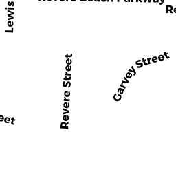
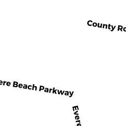
1833 REVERE BEACH PKWY
Owner Information
None
164 BROADWAY
REVERE, MA 02151


Property Details
1833 REVERE BEACH PKWY is classified as a Small Retail and Services stores (under 10,000 sq. ft.) (Store).
The primary structure on this property was built in 2011. There are 12,066ft2 of built area within this property. There is 11,671ft2 of residential/living space within this property.
1833 REVERE BEACH PKWY is valued at $1,986,800. The land is valued at $899,200 and the structures are valued at $1,087,600.
This property is in Zone BD. Confirm with local Zoning Board authorities to ensure there are no overlays or other easements on this property.
The most recent deed for 1833 REVERE BEACH PKWY is recorded at the local registrar in Book 1391, Page 73. 1833 REVERE BEACH PKWY was last sold on Friday, October 15, 2010 for $381,000.
Assessment data from fiscal year 2022.
Flood Data
According to the FEMA National Flood Hazard Layer, this property does not appear to be in a flood zone. It may also be in an area not yet reviewed. Nonetheless, confirm this information prior to taking any action.
To view the flood hazards around this property, create a FEMA "Firmette" Map of the area around 1833 REVERE BEACH PKWY.
Broadband Internet Providers
| Provider | Type | Bandwidth (mbps) | |
|---|---|---|---|
| Starry, Inc. | Fixed Wireless | 200 | 200 |
| netBlazr Inc | Fixed Wireless | 50 | 50 |
| HughesNet | Satellite | 25 | 3 |
| VSAT Systems, LLC. | Satellite | 2 | 1 |
| GCI Communication Corp. | Satellite | 0 | 0 |
| Crown Castle Fiber | Fiber | 0 | 0 |
| Verizon New England Inc. | DSL | 5 | 0 |
| Comcast | Cable | 1000 | 35 |
| RCN | Cable | 500 | 20 |
| Viasat Inc | Satellite | 100 | 3 |
Broadband service provider data from December 2020.
Adjacent Properties
- 201 CHELSEA ST 304
Residential Condominium owned by None - 201 CHELSEA ST 305
Residential Condominium owned by None - 201 CHELSEA ST 307
Residential Condominium owned by None - 201 CHELSEA ST 308
Residential Condominium owned by None - 201 CHELSEA ST 309
Residential Condominium owned by NOMAD DEVELOPMENT, LLC - 201 CHELSEA ST 310
Residential Condominium owned by None - 201 CHELSEA ST 311
Residential Condominium owned by None - 201 CHELSEA ST 312
Residential Condominium owned by None - 201 CHELSEA ST 313
Residential Condominium owned by None - 201 CHELSEA ST 401
Residential Condominium owned by None - 201 CHELSEA ST 314
Residential Condominium owned by None - 201 CHELSEA ST 404
Residential Condominium owned by None - 201 CHELSEA ST 405
Residential Condominium owned by None - 201 CHELSEA ST 406
Residential Condominium owned by None - 201 CHELSEA ST 407
Residential Condominium owned by None - 201 CHELSEA ST 408
Residential Condominium owned by None - 201 CHELSEA ST 409
Residential Condominium owned by None - 201 CHELSEA ST 410
Residential Condominium owned by None - 201 CHELSEA ST 411
Residential Condominium owned by None - 201 CHELSEA ST 413
Residential Condominium owned by None - 201 CHELSEA ST 414
Residential Condominium owned by None - 201 CHELSEA ST 501
Residential Condominium owned by None - 201 CHELSEA ST 502
Residential Condominium owned by None - 201 CHELSEA ST 503
Residential Condominium owned by None - 201 CHELSEA ST 504
Residential Condominium owned by None - 201 CHELSEA ST 505
Residential Condominium owned by None - 201 CHELSEA ST 506
Residential Condominium owned by None - 201 CHELSEA ST 508
Residential Condominium owned by None - 201 CHELSEA ST 509
Residential Condominium owned by None - 201 CHELSEA ST 510
Residential Condominium owned by None - 201 CHELSEA ST 511
Residential Condominium owned by None - 201 CHELSEA ST 601
Residential Condominium owned by None - 201 CHELSEA ST 602
Residential Condominium owned by None - 201 CHELSEA ST 603
Residential Condominium owned by None - 201 CHELSEA ST 604
Residential Condominium owned by None - 201 CHELSEA ST 605
Residential Condominium owned by None - 201 CHELSEA ST 607
Residential Condominium owned by None - 201 CHELSEA ST
Condominium-Association owned by None - 201 CHELSEA ST 101
Residential Condominium owned by None - 201 CHELSEA ST 102
Residential Condominium owned by None - 201 CHELSEA ST 103
Residential Condominium owned by None - 201 CHELSEA ST 104
Residential Condominium owned by None - 201 CHELSEA ST 105
Residential Condominium owned by None - 201 CHELSEA ST 106
Residential Condominium owned by None - 201 CHELSEA ST 107
Residential Condominium owned by None - 201 CHELSEA ST 108
Residential Condominium owned by None - 201 CHELSEA ST 110
Residential Condominium owned by None - 201 CHELSEA ST 111
Residential Condominium owned by None - 201 CHELSEA ST 112
Residential Condominium owned by None - 201 CHELSEA ST 113
Residential Condominium owned by None - 201 CHELSEA ST 114
Residential Condominium owned by None - 201 CHELSEA ST 201
Residential Condominium owned by None - 201 CHELSEA ST 202
Residential Condominium owned by None - 201 CHELSEA ST 203
Residential Condominium owned by None - 201 CHELSEA ST 205
Residential Condominium owned by None - 201 CHELSEA ST 206
Residential Condominium owned by None - 201 CHELSEA ST 207
Residential Condominium owned by None - 201 CHELSEA ST 208
Residential Condominium owned by None - 201 CHELSEA ST 209
Residential Condominium owned by None - 201 CHELSEA ST 210
Residential Condominium owned by None - 201 CHELSEA ST 211
Residential Condominium owned by None - 201 CHELSEA ST 212
Residential Condominium owned by None - 201 CHELSEA ST 213
Residential Condominium owned by None - 201 CHELSEA ST 214
Residential Condominium owned by None - 201 CHELSEA ST 301
Residential Condominium owned by None - 201 CHELSEA ST 302
Residential Condominium owned by None - 201 CHELSEA ST 303
Residential Condominium owned by None - 201 CHELSEA ST 109
Residential Condominium owned by None - 201 CHELSEA ST 204
Residential Condominium owned by None - 201 CHELSEA ST 306
Residential Condominium owned by None - 201 CHELSEA ST 402
Residential Condominium owned by None - 201 CHELSEA ST 403
Residential Condominium owned by None - 201 CHELSEA ST 412
Residential Condominium owned by None - 201 CHELSEA ST 507
Residential Condominium owned by None - 201 CHELSEA ST 606
Residential Condominium owned by None - 1841 REVERE BEACH PKWY
Vacant, Selectmen or City Council (Municipal) owned by None - 1847 REVERE BEACH PKWY
Automotive Vehicles Sales and Service owned by None